Severe storms, hail and damaging winds make way for temps in the 30s
Watch out TNQ, it looks like we could be in for a very hot weekend.
The weather bureau is forecasting maximum temperatures to range between 28C and 34C on Saturday and 27C and 34C on Sunday across TNQ as mostly sunny skies return to the region.
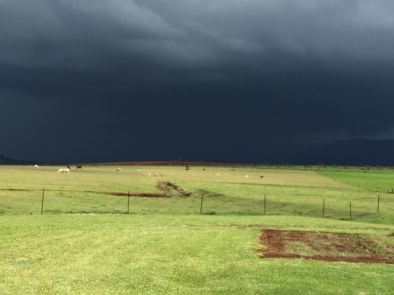
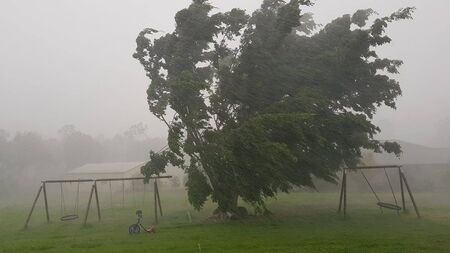
The return of the sun and heat comes after a wild couple of days on the southern Tablelands with towns hit hard by hail, heavy rain and damaging winds in areas around Ravenshoe, Herberton, Atherton and Walkamin.
The severe storms reportedly ripped the roof of the pony club clubhouse at Ravenshoe and also brought down trees and powerlines with homes and businesses in the region without power for some of today.
Herberton recorded 42mm, Malanda 37mm, Atherton 24mm, Ravenshoe 15mm and Tolga 5mm in the 24 hours to 9am.<strike></strike>
The storms are expected to continue today with a chance Cairns may be hit as well, with duty forecaster Adam Blazak saying it is unusual to see hail in TNQ.
“It is very unusual to get hail, it is usually too warm for hail to hit the ground,” he said.
“That’s a sign there is a lot of cold air in the atmosphere above TNQ at the moment.”
The combination of cold air and strong winds in the atmosphere combined to bring the storms but it should return to situation “normal” in the next couple of days and over the weekend.
From tomorrow onwards the severe cells are expected to move south to between Cardwell and Bowen with isolated coastal showers in TNQ.
And for the weekend, it should be mostly fine with the slight chance of a coastal shower or two.
Cairns Regional Council also closed Lake Morris Rd due to minor landslips and fallen trees with the debris expected to be cleared by 4pm.