
Rain at last – but it’s not the start of the wet season
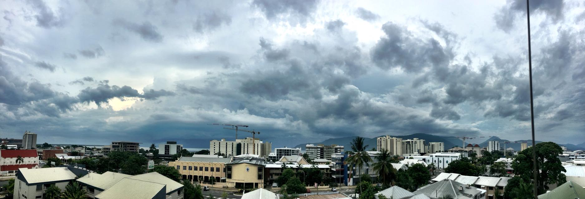
Rain finally arrived last night, and there’s more on the way today, but it doesn't herald any monsoons in the near future.
More than 11mm fell at Cairns Airport and 16mm at Cannon Park last night, cooling Cairns down today by more than 4 degrees below yesterday’s maximum of 36.9 degrees. Other figures from the Bureau of Meteorology included 42mm at Hill’s Creek, just across the Inlet from Cairns.
BOM meteorologist, Adam Blazak, says it’s looking very good for rain after lunch today with lots of instability and moisture around, and a possible thunderstorm.
He said a ridge extending up the coast north of Townsville to Cooktown should ensure good falls which will continue through the evening and into tomorrow morning.
But the relief is short lived, with showers easing tomorrow (Saturday) and just a possible shower forecast for Sunday. The winds are picking up though, with 15 to 25 km/h predicted for this afternoon, increasing to 25 to 40 km/h tomorrow morning.
Further afield, Topaz received 38mm, Daintree 35mm and Hill’s Creek 42mm.
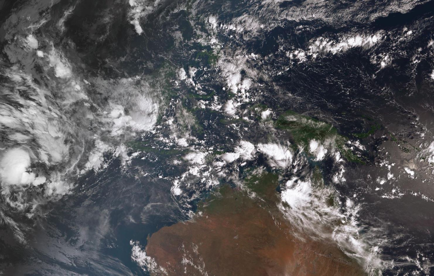
NO WET SEASON YET
If you are wondering what has happened to the start of our annual wet season – the answer is it is happening – just not here.
While typically we begin to experience the Australian monsoon season by December, the last time the onset date was this late was during the 2011-12 wet season.
One factor contributing to the delayed start of the wet season is the continuing tropical activity in the northern hemisphere.
The Bureau of Meteorology notes that a late-season trough persists in the northern hemisphere, extending from a developing low near the Philippines to another weaker tropical low in the Bay of Bengal.
According to BOM’s Weekly Tropical Climate Note issued yesterday, this trough lessens the likelihood of monsoonal flow developing in the Australian region by deflecting energy associated with cross-equatorial flow from the South China Sea.
This flow from the South China Sea ideally would energise a southern hemisphere monsoon trough and thereby assist in starting the northern Australian monsoon onset.
The tropical depression near the Philippines may reach tropical cyclone strength in the next few days as it moves towards Vietnam.
BOM’s report also noted that while the monsoon trough briefly influenced the north Western Australia coast in association with tropical cyclone Hilda about a week ago, northern Australia is yet to experience broad scale monsoonal flow this wet season.
LA NIÑA
There’s also no relief in sight from La Niña conditions which persist in the tropical Pacific, with climate models suggesting this La Niña will be weak and short-lived. BOM forecasts this usually means less influence upon the Australian tropics.
La Niña is typically associated with above-average rainfall during the northern wet season, average or above-average tropical cyclone numbers across the Australian region and an earlier onset of the Australian monsoon.
However, BOM notes this event is atypical in a number of aspects including its late development and influence on sea surface temperature across northern Australia.
By convention, the Australian monsoon onset date occurs when the onset is observed at Darwin.