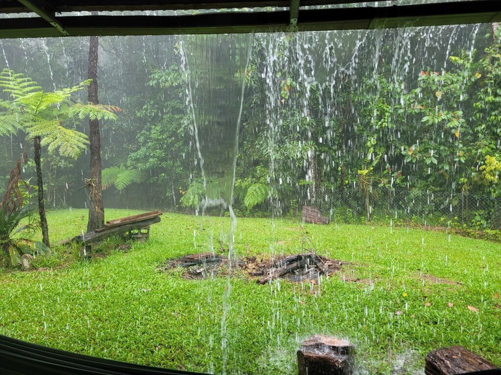
While Cairns has managed to dodge the region’s heaviest rain overnight, conditions over this afternoon and tonight are still being described as ‘risky’ by forecasters.
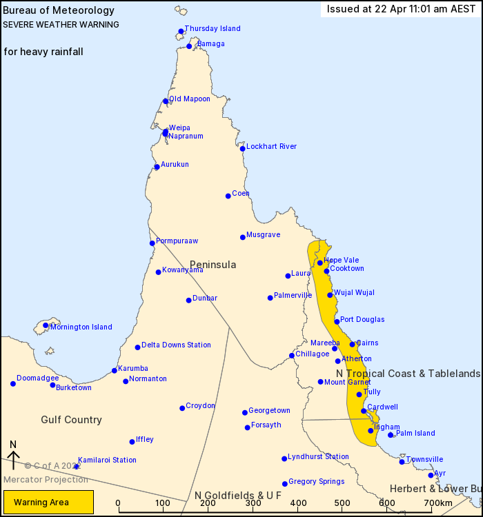
The Bureau of Meteorology (BoM) issued its latest ‘severe’ weather warning at 11am this morning, with predictions of heavy rainfall impacting people between Hope Vale and Ingham.
##IAA1##
BoM spokesperson Brooke Pagen said Cairns can expect the rain to pick up later today.
“At the moment there’s quite risky conditions in the region,” she said.
“Widespread showers are slowly moving onshore and could really pick up later this afternoon.
##PQ##
“Although it's a decreasing threat, localised intense rainfall is also possible with six-hourly totals of 300mm.
“With that warning still in place we’re keeping an eye on river levels.
“The river rises aren’t anything too significant yet but people are recommended to stay off the roads if they can.”
You can keep an eye on Cairns Regional Council’s flood camera’s here.
Widespread showers are slowly moving onshore in FNQld as a trough lingers off of the northern QLD coast. Severe storms with heavy rainfall possible between Rollingstone and Cooktown, risk likely to contract north of Innisfail from this evening. Warnings: https://t.co/FBmpsInT9o pic.twitter.com/Vxo625DQFC
— Bureau of Meteorology, Queensland (@BOM_Qld) April 22, 2022
While Cairns Airport only recorded 63mm in the 24-hour period to 9am Friday morning, several weather stations south of Innisfail recorded almost triple that amount.
169mm fell over South Mission Beach, while Cowley Beach notched up 163mm and Bulgun Creek near Tully recorded 168mm.
In the north, the Daintree region’s Diwan station collected 158mm.
Ms Pagen said the wet weather is looking to slightly ease by midday Saturday.
“There’s still a high a chance of showers over the weekend but tonight it looks to be easing,” she said.
“By midday tomorrow or potentially earlier that trough could shift north.
“Tomorrow Cairns could receive between 60 and 100mm, while on Sunday those totals will “likely be between 45 and 70mm.”