
##MP##
Meteorologists in several countries are closely monitoring a tropical low in the Coral Sea, which is expected to develop into a tropical cyclone as early as Wednesday.
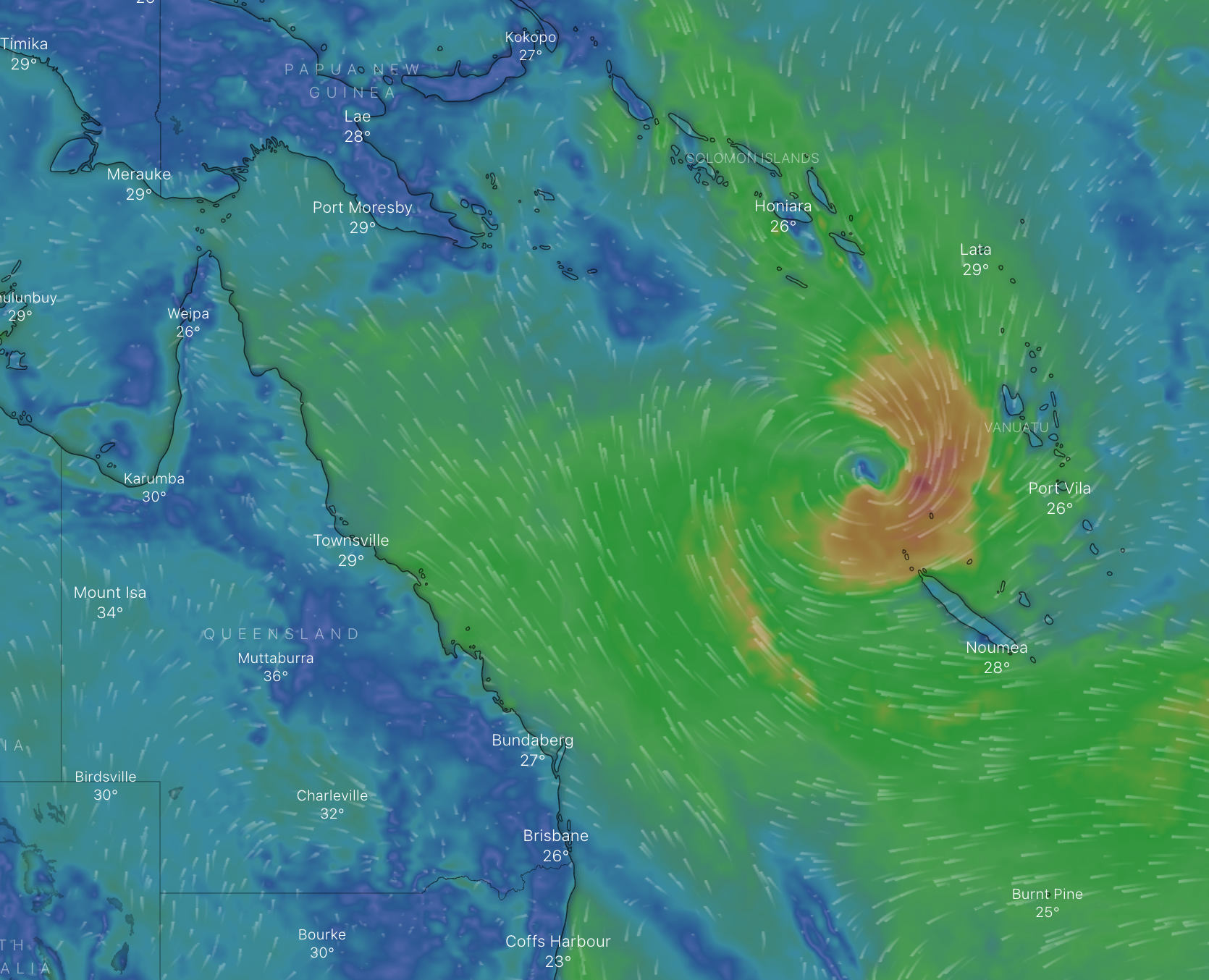
The system is currently sitting just west of Vanuatu.
While it is expected to initially track further west, the Bureau of Meteorology says it is unlikely to come close to the Queensland coast.
##BA##
Forecaster Steve Hadley told Tropic Now the low is now under the jurisdiction of Fiji’s weather bureau, which has already issued a gale warning.
“The Fiji Meteorological Service say there's a high chance of this developing into a cyclone after 36 hours,” he said.
“It’s just starting to become a little bit more organised on the satellite images.”
The system is predicted to track southeast once it forms into a cyclone.
“It’s slow moving right now but the models have it moving south-westwards initially and then southeasterly in the mid to latter part of the week,” Mr Hadley said.
“It is more likelier than not for it to stay well away from the Queensland coast.
##PQ##
“Norfolk Island may get some stronger winds.”
A second potential low is also being closely watched.
The Bureau of Meteorology says it could form in the Solomon Sea and move south during the week, well away from the Australian coast.
That system is not expected to develop into a tropical cyclone.
Main points
- A tropical cyclone is expected to develop in the Coral Sea as early as Wednesday
- The system, currently a low, is only expected to deliver larger ocean swells for Queensland
- It is currently sitting just west of Vanuatu