

##MP##
Thunderstorms have brought much-needed rain to parts of Far North Queensland, and there may be more to come.
Storms began developing across Cape York, the Atherton Tablelands, and the Cairns region on Tuesday afternoon.
High temperatures encouraged convection and atmospheric conditions combined to trigger a possible start to the wet season.
Rain and storms continued well into the evening, with impressive lightning displays and thunder frightening dogs across the region.
##BA##
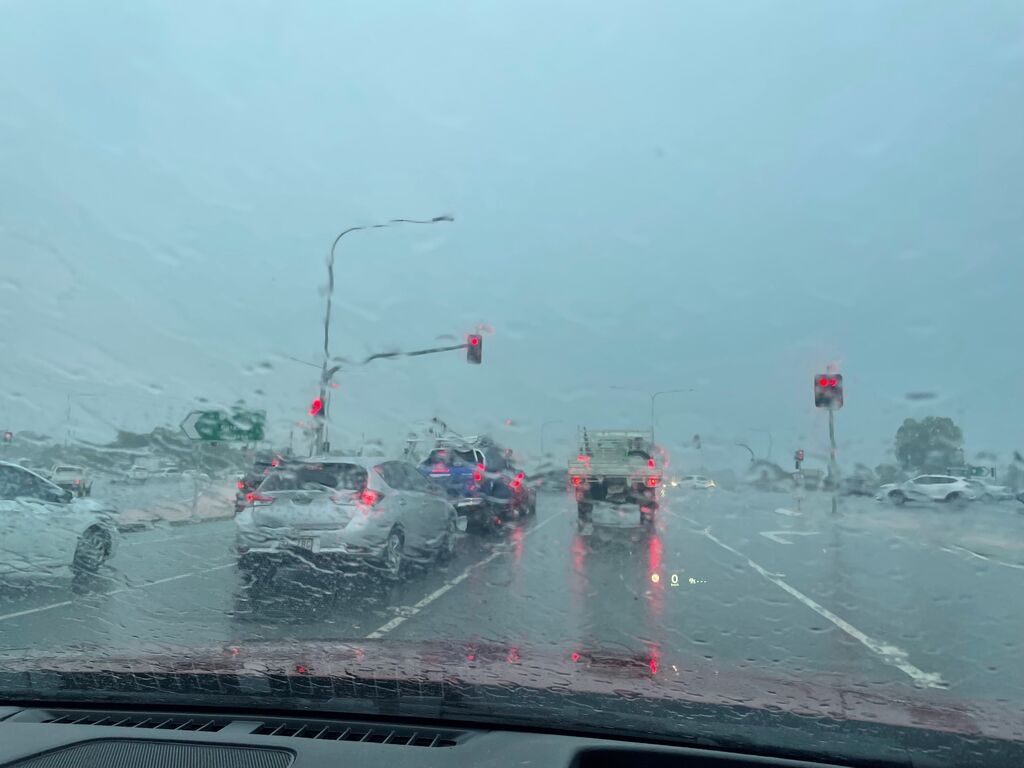
Power failures were reported at Mareeba, Stratford, Freshwater, and in the Cairns northern beaches during the storms.
At Cairns airport, 16 millimetres fell from storms that began around 4pm.
The rain gauge at Cannon Park racecourse picked up 20 millimetres in the same period.
Areas of localised heavier falls occurred on the Cairns northern beaches, generating difficult driving conditions and deep roadside puddles along key access roads.
Travellers on the Kennedy Highway reported heavy falls between Mareeba and Cairns, while 20 millimetres was recorded at the Low Isles, east of Port Douglas.
The Bureau of Meteorology issued a severe thunderstorm warning for parts of our region during the afternoon.
It said areas of slow-moving thunderstorms were developing in the North Tropical Coast and highlands regions, warning of the possibility of heavy rainfall and flash flooding.
Rainfall figures included Sutties Creek, inland of Innisfail, with 63 millimetres in one hour, and Glen Allyn, on the Atherton Tablelands, recording 53 millimetres in the 30 minutes to 4:12pm.
Scrubby Creek, on the Atherton Tablelands, recorded 61 millimetres in the hour to 4:41pm.
Earlier this week, the Bureau of Meteorology warned that parts of Far North Queensland were about to get their first taste of the wet season.
The Bureau said there were signs a monsoon trough developing over maritime areas north of the Northern Territory that could help generate a tropical low-pressure system in the Gulf of Carpentaria.
There’s a very low risk of it becoming a cyclone in the short term, and the BoM says it will move east-south-east across Cape York Peninsula and into the Coral Sea.
Longer term, there’s a slightly higher chance the low could become a cyclone over the Coral Sea, but it’s expected to move south-east away from the Queensland coast.
The BoM says there’s a high to very high chance of rain and storms across FNQ for the rest of this week.
Main points
- Storms delivered widespread rain across FNQ
- More rain forecast as wet season develops
- Tropical low in Gulf but not expected to become a cyclone