TNQ to get a drenching today but 'too early to tell' on potential cyclone
The Bureau of Meteorology only has one word to describe the weather in the Cairns region this afternoon: “wet”.
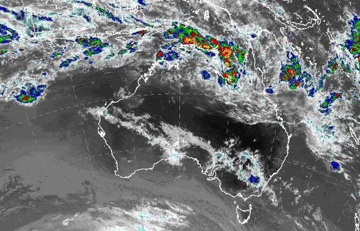
That’s the succinct summary by duty forecaster Chris Joseph when it comes to the prediction of heavy falls along the TNQ coast later today.
As for the chance of a cyclone forming in the Coral Sea next week? Mr Joseph would only say it’s too early to tell.
After today’s drenching, local residents are in for a slightly drier Australia Day long weekend ahead.
“We’ve got the Coral Sea trough lying just offshore of the north tropical coast, and that’s set to stay in the region through today and tomorrow before it slowly starts to track northwards over the next few days,” Mr Joseph said.
“We have a high chance of showers and a storm through the north tropic coast today because of that trough, but from Australia Day onwards the trough moves further north which will see some of the shower activity easing.”
The Bureau’s cyclone outlook rates the chance of a cyclone forming over the next three days as “very low”.
But another burst of monsoonal activity early next week could create the type of conditions conducive to a cyclone.
“It’s way too early to say anything, but computer modelling suggestions we’re in for another burst of monsoon activity through the top of Australia early next week so that could mean the trough develops further in the Coral Sea,” he said.